
There’s nothing like going in at the deep end. Katie and I used to climb munros together when we worked on newspapers in Glasgow 20 years ago and more.
I hadn’t bagged any new summits for a couple of years, while Katie now lives in the Western Isles and had been away from the hills since before the Covid years.
So, rather than tackling a nice single-munro day to stretch the legs, we decided to do one of the big hill days, taking in four munros and a fair bit of walking besides.

This is a huge day, whichever way you tackle it. Starting at the Loch Mullardoch dam, the full route can be taken in either direction, with a long loch-side walk on a rough path to start the day or after an already long trek on the tops. It’s also worth noting that there is no bridge over the Allt Taige, which can be impassable in spate.
We were lucky, then, that the boat service was running, and managed to skip this extra distance on an already challenging day out – but that’s not a guarantee, as the service won’t be running all summer this year.
We were dropped at the bay where the Allt Coire a’ Mhaim and the Allt Socrach flow out into the loch, and made our way up to the right of a small area of trees surrounding a wooden lodge.
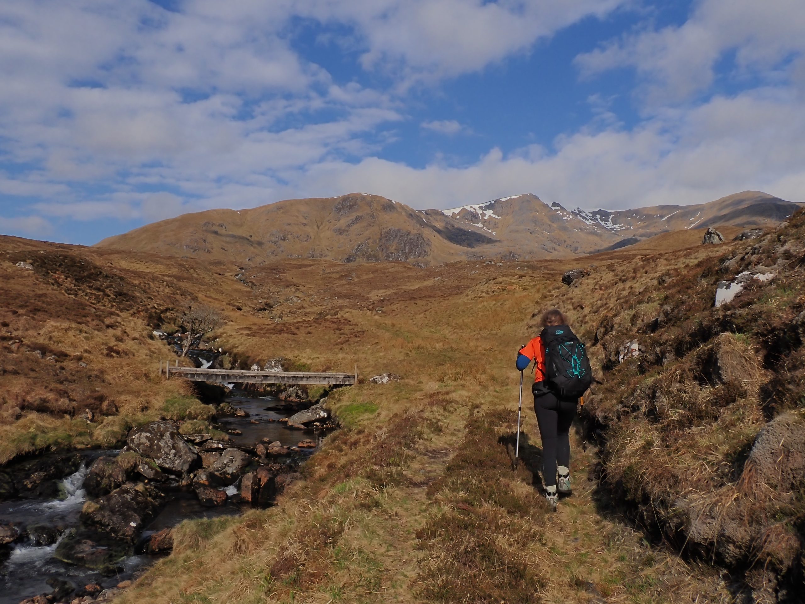
We were aiming for the munro of An Socach first, so we ignored the bridge off to the right and continued up between the two burns to reach a plank bridge (marked on the Harvey map but not the OS ones) over the Allt Coire a’ Mhaim further upstream.
A leg-sapping stretch of peat hags leads to the base of the broad ridge that curves up this remote hillside. Despite a forecast that suggested just a 10 per cent chance of cloud-free munros, the sun was out and I was regretting not packing the sun cream at this stage.
Higher up, the views back over Loch Mullardoch to the munros of Affric were captivating, Beinn Fhionnlaidh prominent across the water. Soon there was snow hanging in the corries, and a good amount of it, too – although none obscured our way.

Cloud was drifting over the top of the huge corrie rim, which we rounded over Meall a’ Chaisg to the trig point on An Socach at 1069m, our first munro of the day, and one of the most remote.
From here, the other munros of the route are tackled on a long ridge walk. It starts with a short easy section before descending steeply to the Bealach a’ Bholla followed by some easy (and fun) scrambling up through rocks to the 1040m top.
The route here turns south-east to follow gentle grassy slopes to another subsidiary top at 1080m before continuing west-north-west to the second munro of the day, An Riabhachan. We sat here in T-shirts enjoying our lunch, belying the doomy forecast, although it was predicted to get worse as the day wore on, so we decided to continue moving.
Our next target lay 2.5 kilometres to the east and was the highest munro of the day at 1150m. Another steep drop above the Creagan Toll an Lochain is along a fine, narrow path with optional outcrops to clamber over.

It was along here that I glanced up to watch a golden eagle emerge from the cloud above me, no more than 30 yards ahead. I shouted to Katie to look, and the bird circled up back into the cloud then glided across the ridge and away into the corrie below.
We continued down to the Bealach Toll an Lochain at 820m before a long, steep slog up to Sgurr na Lapaich, where the terrain changes at the top to an area of large, black boulders. The clag started to stick now, and we donned our jackets at the trig point and wind shelter.
The compass was called for as the visibility reduced dramatically just at the most awkward part of the route. The ridge is quite complex here, as the true east ridge is rocky and dangerous, while a secondary ridge that runs roughly east-south-east to the Bealach na Cloiche Duibhe opens up the route to the final munro of the day.
We followed the bearing initially east, planning to turn south-east after a steepening to avoid the true east ridge, but the huge boulders seemed to drop away to a snow patch that we could barely see through the cloud.
Our uncertainty led us back to the trig point, where we decided a safer option was to descend through the boulders from there, taking a bearing directly down the correct ridge. It was awkward without being technical, and we soon found ourselves below the snow slope that we had seen from the top.

Between the snow patches, we found segments of a well-trodden path, and the going got easier further down, though the cloud failed to clear.
The climb to Carn nan Gobhar was straightforward after that, with a steepening in the middle part of this final ascent of the day. We didn’t see goats on the hill of the goats, but we had seen them earlier in the day.
The usual route off here follows the south ridge over Mullach na Maoile, but I’d read about an alternative that goes east to the bealach between Carn nan Gobhar and Creag Dubh, then descends into the huge bowl that contains several burns converging in the Allt Mullardoch.
It was soggy in here with unmarked watercourses coming from all directions and no path at all. We made our way so far down then headed in a vague direction across the coire aiming for a stalkers’ path at the base of Glun Coire na Buidheig.
We landed straight on it, crossing the Allt a’ Choire Dhuibh to join the path on the corner before following it downstream to a small hydro scheme, from where a good track was a pleasure to walk on after a long, tough day.
The track bends left towards the dam and it was a relief to finally reach the car and look back on a wonderful day shared in these spectacular and remote mountains.

Route details
Mullardoch munros
Distance 13 miles / 24 km (plus an extra 4.5 miles / 7km for the full circuit)
Terrain Rough mountain terrain, navigation skills and equipment required
Start/finish Head of Glen Cannich, at the Loch Mullardoch dam
Map OS Landranger 25; OS Explorer 430
A long ridge walk taking in four remote munros above Loch Mullardoch
Click here to see the route in OS Maps