
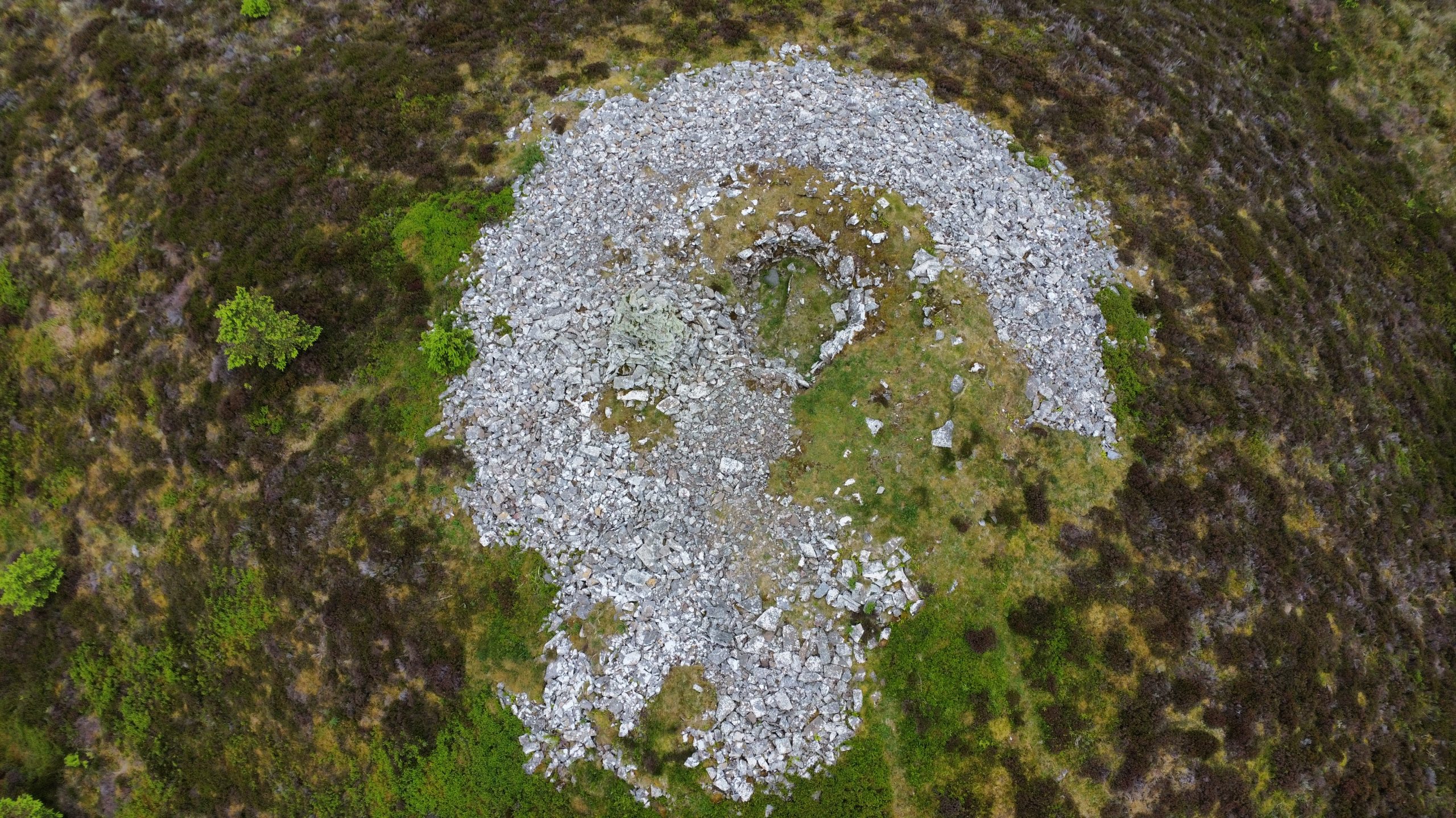
Stone Age structures and a vast array of archaeological evidence give a glimpse into the lives of the people who have called this small area of Caithness home during the last 5000 years.
The Yarrows Heritage Trail was first created in the 1970s when then Highland Council archaeologist Bob Gourlay recognised that a designed walk through this landscape would make it accessible to the public.
Today, it is looked after by an entirely voluntary group, Yarrows Heritage, whose members are passionate about sharing the history of this fascinating area.
The group recently held a guided walk to share some of the improvements made to the two-and-a-half mile route, as well as some of their knowledge of the archaeological features in the Yarrows Basin.

I couldn’t make the guided walk so decided to visit the trail myself instead. It is located a short distance south of Wick, off the A99 at Thrumster – take a minor road signed to Haster then a left turn, signed towards the trail, and follow the single-track road to a small car park beyond a croft as you approach the end of the Loch of Yarrows.
You can walk the route either way, but I decided to start by visiting the broch on the edge of the loch. To walk this way, look for the yellow arrow on a gate at the bottom of the car park and follow a muddy stretch through a field.
A cuckoo was calling from across the moor as I headed off. There are several stiles to cross on this walk, as well as some very boggy sections and a bit of uphill walking, so a reasonable level of fitness and dexterity is required. There may also be livestock on parts of the route, but not on my visit.
The volunteers at Yarrows Heritage have spent some time renovating the trail recently, with new leaflets, information boards, signage, waymarker posts, and specific information at each site. I could clearly see the effort that had been made with freshly painted marker posts, repaired stiles and new posts with QR codes that give direct links to fascinating information about each of the features along the way. There’s even a good data signal so the info loads quickly!
Don’t expect smooth, purpose-built paths, though – this is a walk through the heather, moor and bog and gives a wild feel, enhancing the experience of going back in time through the ages.

The broch, once known locally as the Cairn of Yarrows, was excavated in the 19th century and a wall around 11ft tall was still in place in 1910. The link on the QR code also explains that five human skeletons were unearthed at the site.
Going through a gate, the trail is straightforward to follow thanks to the mixture of yellow arrows and marker posts topped with fresh white paint. A little further on, the route goes left between two fences to reach the remains of the first of two hut circles on the trail.
These roundhouses were common dwellings in the Highlands and date from the Bronze Age and Iron Age. Continuing over a few small rises in the landscape, a second hut circle is passed before a longer climb up through the heather to the features close to Warehouse Hill.
A couple more stiles are passed on the way up, along with some short flagstone boardwalks that cross some of the wettest sections of the walk.
Towards the top, the first stone feature you see is a large cairn which rises above the top of one of two ancient cairns. This upright structure is actually a later addition, built in Victorian times, but still drips with lichen in the fresh air.
But first, you reach Warehouse South chambered cairn, which was one of the first pre-historic cairns to be excavated in Caithness, in 1865. It is one of several long cairns on this walk alone, with many others in the wider area including at Camster.

There’s a fine view over the croftland down to the Loch of Yarrows from here and, looking around, out to the offshore wind farms in the Moray Firth and, closer, past the Burn of Whilk wind farm towards Scaraben.
You can have a look around the archaeological sites but many of them are protected monuments and it is therefore a criminal offence to damage them or remove stones.
It’s only a short hop to Warehouse West Cairn, which is slightly different to the other long cairns and is thought to date from the Bronze Age – a relatively recent addition to the area. Another skeleton was found in a cist here, perhaps highlighting the importance of the Yarrows as a prehistoric burial site.
The trail turns right here, dropping down over a boggy section then up towards the ridge that edges the basin, passing what is believed to be an Iron Age fort.
A lovely walk down the ridge follows, with a view ahead to the Loch of Yarrows and out beyond Wick into the firth.
Further down, another couple of long cairns are reached at South Yarrows, rather confusingly called South Yarrows North and South Yarrows South long cairns. These are Neolithic burial cairns, again similar to the well-preserved example at Camster and dating back around 5000 years.
There is so much history to discover in Caithness, and it’s great to see this band of volunteers dedicating their time to preserving and sharing the past on the Yarrows Heritage Trail.
From the south cairn, the path drops a short distance back to the road just a few yards from the car park, completing the circuit. Meanwhile, that cuckoo was still going, having accompanied me most of the way around the walk!

Route details
Yarrows Heritage Trail
Distance 2.5 miles / 4 km
Terrain Waymarked route on hillside paths; very boggy in places; stiles and gates with rough walking in places
Start/finish Yarrows Heritage Trail car park, off A99 at Thrumster
Map OS Landranger 12; OS Explorer 450
Exploring a series of remarkable archaeological features on this volunteer-run heritage trail in the heart of Caithness
Click here to see the route in OS Maps
Another lovely invite into the history of this part of Scotland. Good write up John. D