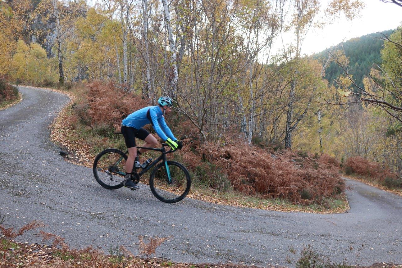
Twisting its way up through a series of tight hairpin bends, the locally-named corkscrew road at Inverfarigaig climbs from the shore of Loch Ness high into the hills above.
There are no passing places and very little room for manoeuvre, so you have to hope you don’t meet anything coming the other way – even on a bike.
It had been some time since I’d cycled it but decided this time I would head down the corkscrew instead of up, planning a nice little circuit from Inverness along the wonderful south Loch Ness roads.
I was joined on this quiet Sunday morning outing by my friends Rich and Paula, as we set off towards the Essich roundabout on the south side of the city. You can join the signed cycle route 78 here, going straight on through the roundabout then turning right just before some new houses.
A surfaced cycle path takes you alongside the B862 past Cullaird to Scaniport, from where you join a quiet road through Strath Dores.
Beyond the B&B at Antfield, we went left at the junction – now leaving route 78 – to climb the long Macbain hill to the crossroads above Loch Ashie. This is a popular spot with local cyclists, with so many circuits that can be done in this area, though today the roads were surprisingly quiet given the pleasant weather.
We turned right across the moor, enjoying the open road despite a slight headwind. On reaching the junction with the B road, Paula decided to drop down to Dores and meet us at Inverfarigaig – not wanting to risk her good bike on the deteriorating surface through the farm that leads to the corkscrew.

Rich and I carried on, heading left at the junction to cross a cattle grid and enjoy views over Loch Duntelchaig to our left. Following the road below Tom Bailgeann we passed the delightful Loch Ceo Glais. It had been a while since either of us had ventured this way, so it rekindled a love of the area that’s so close to home.
Beyond the end of the loch, we took the road off to the right where the main route bends sharply left. There’s no sign here but this minor road is still marked on the latest maps as a public road, despite the state of it further on – it certainly isn’t recommended in a car and definitely not in anything bigger!
For now, this fine single-track road contours above the River Farigaig in this lovely little strath, skirting through forest and farmland, with cattle having open access including to the tarmac in places.
The road surface does get worse, though there have been some repairs done, with chippings used to fill in the worst of the potholes at first.
We were just enjoying the journey, carefully avoiding the worst of the poor surface, when we came around a corner to be confronted by a cow staring at us while enclosed between a fence to our left and a wall to our right.
This could have been interesting but thankfully ‘Daisy’ was equally as perturbed and did an about-turn, cantered to the end of the fence and found herself some grass to chew on. Relieved, we slowly cycled past, taking in the view to Dun Deardail and Loch Ness ahead.
The craggy hill of Dun Deardail is topped by the remains of an Iron Age fort, though there is no clear way to the top of this steep-sided summit and it’s not a place I’ve tried to explore on foot.
Having passed through a closed gate on the road, we now headed into the trees, grass growing in the middle of the road and potentially slippery leaves, mud and loose stones adding to the need to concentrate and take things slowly.

Then, all of a sudden, the surface changed to smooth tarmac. We had arrived at the top of the corkscrew. This incredible road was built in 1815 by William Fraser-Tytler and his father Lord Woodhouselee.
Watching through the trees for any traffic heading upwards, we rolled down, hitting the brakes to slow down sufficiently for each massive twist in the road. In hardly any time we were at the bottom, where we turned right to pass the houses at Inverfarigaig and head north again along the shore of Loch Ness.
Across the water we could see Urquhart Castle, while closer to hand we noticed the miles for the Loch Ness Marathon marked on the road surface – one of many events hosted in the area that show off this wonderful place.
Another is the Etape Loch Ness and, having missed it for the first time this year, I have just entered again for 2019. I can look forward to riding this final stretch of the 66-mile route back to Inverness when the road is closed to traffic in April.
Reacquainted with Paula now, we made our way quickly back to Dores with the wind behind us and, just before the school at Aldourie, we turned right to take the nice little cycle path that cuts through the fields to join the minor road at the bottom of the Macbain hill. From here, we made our way back to Scaniport on the road then home to Inverness.
Route details
Inverfarigaig cycle
Distance 33 miles / 53km
Terrain Mostly on quiet roads, very rough surface towards the Corkscrew
Start/finish Inverness
Map OS Landranger 26, Inverness & Loch Ness
Twisting and turning through glorious cycling country to reach a magnificent old road
