I’ve made no secret of my love of this low-level walk that gives a glimpse into the awe-inspiring landscapes of Glen Affric, so it was a pleasure to lead a group of Ramblers around the loch.
As part of my Mountain Leader training, I’ve been trying to gain more experience not only in the hills but also with the other necessary skills to take people out into the wilds.
The Inverness Ramblers have been kind enough to let me lead a couple of walks during their autumn/winter programme and this was my first outing with them.
As we gathered in Inverness before car-sharing to reach the car park at the end of the glen, the fog was looking thick and steadfast. It didn’t shift the whole way, so we set off on foot into the gloom, crossing the bridge over the River Affric into the forest on the south side of the loch.
A wooden signpost directs you right at the top of a short rise on the Affric Kintail Way, a long-distance route that connects Drumnadrochit on Loch Ness to Kintail through this wonderfully wild country.
We plodded past the new Allt Garbh hydro scheme, with its buildings pretty well integrated with the landscape now it has settled in.

Heading along the Yellow Brick Road – as this stretch of estate track is referred to by entrants of the annual Highland Cross duathlon – we reached the top of a rise and were welcomed by an astonishing view over the water to Sgurr na Lapaich and An Tudair, two massive tops that rise from the water to over 1000m above sea level.
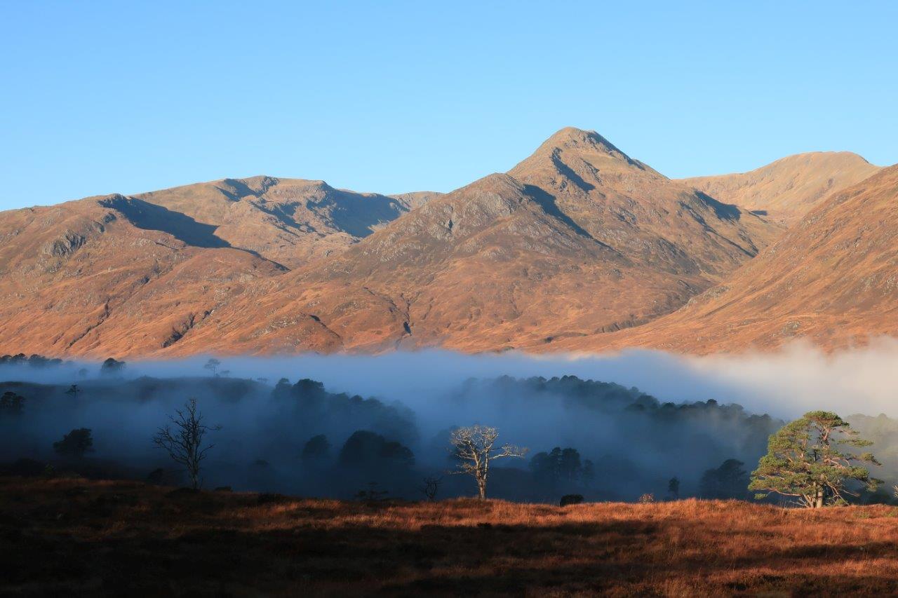
The remaining cloud hung mesmerisingly among the branches of Scots pine that line the Lochside, while, above, the sky was crystal clear, giving a sensational light to this glorious inversion.
After the cameras were put away we continued along the track and I chatted with various group members, all of us enjoying the sense of place. Then I learned the really important part of being a Rambler – the coffee stops!
We located some good boulders alongside the track and found our perches, sipping our hot drinks from flasks and taking in the scene. I’ve been here on many occasions and these conditions made for something particularly special, despite the fact we were mostly in the shade on this side of the loch.
Our route took us past the end of Loch Affric, where we forked right down towards Athnamulloch. The renovated bothy here is run by the charity Trees For Life, which uses it for work parties when planting trees and doing other conservation work in the area. It is locked so not open for use by walkers.

Crossing the river by the wide bridge, we passed Strawberry Cottage – a private mountaineering club hut – and followed the now rougher track up over the shoulder of Torran Beithe to a path junction, marked by another Affric Kintail Way marker.
The view west to Kintail was glorious and I’m always tempted to venture further but with a group to get back to the cars before dark I reckoned we’d better stick to Plan A!
The route round the loch goes right here, below Cnoc Fada and up to Loch Coulavie. We were in the sunshine now, so coats were shed as we made our way along the path on the north side of Loch Affric, which stays high above the water as it passes below the dominant mountains of the region.
There are a few burns to cross along this stretch but the only one of any significance is the Allt Coulavie. We met a few folk on ebikes coming the other way and helped them across with their heavy vehicles before ensuring all our party got across safely.
For me it was a reminder that some of the terrain that I might think of as straightforward when out with friends or by myself can be challenging for others – something I need to bear in mind when leading.
After another coffee stop we continued below An Tudair then Sgurr na Lapaich, that fine outlying top of Mam Sodhail where Peter Evans and I had walked just a few weeks previously. Today would have been another fine day on those excellent ridges but we were having just as good a time down here in this beautiful glen.

At a gate the landscape changes immediately, the regeneration of the forest clear to see inside the enclosure compared to out on the open hills, where the young saplings are given little chance to thrive due to the number of deer roaming the hills. There was more wildlife to spot inside here, with birds flitting from tree to tree in search of food.
As we approached Affric Lodge we could hear gunshots ringing out, alarmingly loud and close to hand. We slowed our pace as we got nearer and were a little shocked to see the keepers and paying guests shooting game – some of them from the path itself!
They held their fire as they saw us approaching and we chatted amicably as we passed but it was something I’d never seen before – live shooting on a popular and well used right of way, rather than away from the main thoroughfares.
Thankfully we came through the area unscathed – much like many of the birds, in fact – and just had the short stretch of track that leads from the lodge back to the road-end to enjoy in peace again.
Returning home the fog was still thick, while we had enjoyed a magnificent day in the sun on this fabulous walk. It was well worth getting out for!
* To see the Inverness Ramblers walks programme, see www.ramblers.org.uk/inverness


Route details
Loch Affric circuit
Distance 11 miles / 18km
Terrain Estate track and remote mountain path, water crossings
Start/finish River Affric car park, end of Glen Affric road
Maps Harvey British Mountain Map: Knoydart, Kintail & Glen Affric; OS Explorer 414 & 415; OS Landranger 25
Leading a walk round the loch with the Inverness Ramblers