Am Faochagach may appear as one of the less dramatic of the 282 Munros with its rounded ridge curving neatly to reach its summit but Sir Hugh certainly had an adventure here.
The Scottish Mountaineering Council’s book on the North West Highlands quotes his contemporary HGS Lawson, who joined him at the Aultguish Inn the next day in 1901.
Lawson describes his return to Strath Vaich when he had difficulty crossing a stream in the dark: “Eventually he returned to a keeper’s house, the occupier of which mounted him on a steed and sent him down the glen in great style. He ultimately arrived at the inn well after midnight.”
Fittingly, when Peter Evans and I set out to climb Am Faochagach recently, members of the Munro Society – an organisation for people who have “compleated” all the hills in Scotland over 3000ft (914m) – were staying at that same inn.

We met one of their number as we set out into the driving rain from the west end of Loch Glascarnoch at Torrain Dubh. I’d decided on this hill partly because of its boggy start and river crossing, which I’d reckoned would be as easy as it could be after the long, dry spell this summer.
It was wet underfoot, however, as we crossed a stile and headed north-east then north towards the Abhainn a’ Gharbhrain, which feeds into the reservoir.
I’ve never seen such little water stored here and, although we were not far from the water’s edge on the map, it was a long way to where the edge of the loch really was. From the road you could see tracks which are usually submerged and much of the dam itself was visible from the west.
There was more water in the river than I’d anticipated, though, and while we managed to boulder hop across it using our walking poles for stability, our friend from the Munro Society was a little concerned about getting back across later in the day.
We brushed those worries aside and headed onwards, climbing the slope on the south-east side of the Allt na h-Uidhe where there’s a vaguely worn route zigzagging up the steepest parts. You then bend right, away from the burn, and head up to the shallow bealach below Sron Liath.
")
")
")
The cloud was coming and going but the rain had stopped as we started making our way along the ridge, first aiming for the 845m spot height about 35 minutes’ walk away. A track, marked on the map, isn’t obvious at the bealach but we picked it up for a while on the rise.
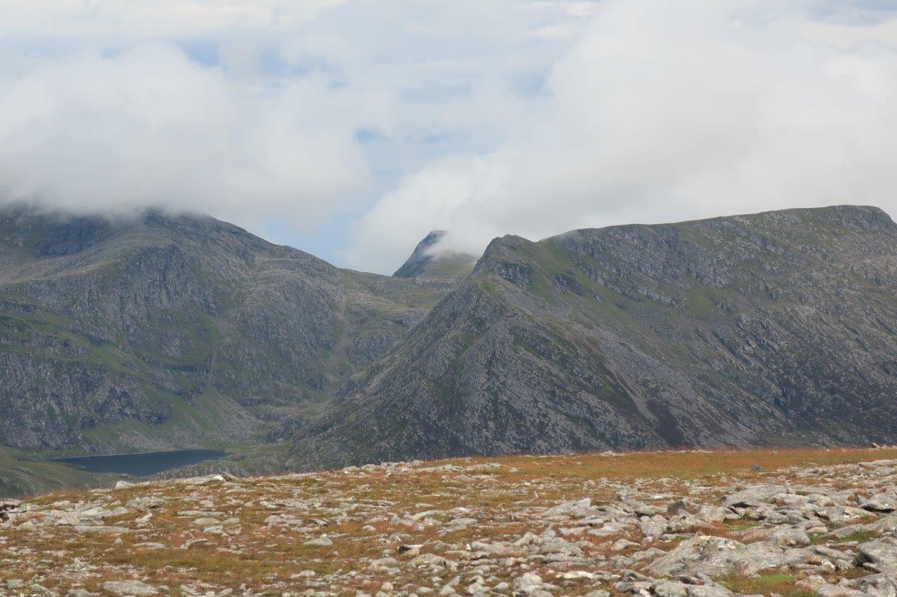
By the time we got to the point, the summit was almost visible as the cloud thinned, although looking across the Dirrie More we could see the tops of the Fannaichs were shrouded and, further west, the angular ridge of An Teallach was just hidden.
After a little dip in the ridge, it bends right and we ascended to the summit cairn at 954m above sea level. Our eyes were now fixed on the nearest hills, the Beinn Dearg range, and in particular the dramatic-looking ridge leading up to Cona Mheall.
Around eight or nine years ago we’d attempted a winter route up here but after hours bashing through waist-deep snow had given up and turned back. Seeing it in this light rekindled our idea and plans are already re-forming to tackle the grade 1 scramble up Cona Mheall’s south ridge.

We also got a good view of Seana Bhraigh, which sits alone at the head of Strath Mulzie. This is another hill we had plans for – including an overnighter at the bothy beside Loch a’ Choire Mhor at its foot – but one I still haven’t climbed.
Our friend arrived behind us at the summit of Am Faochagach as we sat eating our sandwiches beside the cairn. He told us he had 20 to go to “compleat” his Munros – for a second time. Not bad for a man of his age with a heart condition.
The return was predictably a little quicker as we followed the same route back, at least until we hit the river. Despite the rain having stopped, there was much more water in it than earlier in the day and we marched up and down the bank trying to find a safe point to cross.
There were various markers people had left, presumably to remind them where they had crossed on the way out, including a cairn, a walking pole and – rather bizarrely – a pair of old “Sunday best” shoes!

We eventually settled for the least worst option, knowing that it wasn’t far back to the car even if we did get wet feet at this stage. There was some force in the water, however, and I was glad to have the single stick for support, even if it wasn’t quite as good as the pair Peter had with him.
As we plodded back to the car (with wet feet) we kept an eye out to make sure our friend had made it across safely, too. As we got to the car, we saw him head over the final rise behind us – ready to head back to the Aultguish Inn, some time earlier than Sir Hugh Munro himself had managed all those years ago.
Route details
Am Faochagach
Distance 9.5 miles / 15km
Terrain Pathless mountain; river crossing must be negotiated twice (impossible in spate)
Start/finish Torrain Dubh, west of Loch Glascarnoch on the A835
Maps OS Landranger 20; OS Explorer 436
A single Munro with a tricky river crossing to start and finish