Alfred Wainwright is more commonly associated with the Lake District but it is his description of the Dundonnell and Fisherfield forests that has given this area its legendary status in mountaineering – the great wilderness.
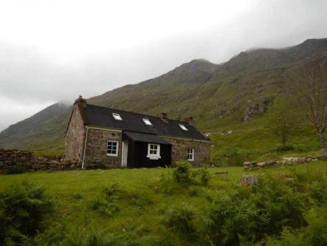
Shenavall bothy provides a popular overnight shelter for those wishing to access the remote mountains of Fisherfield, which lie in a vast area of wild, inhospitable land. It is one of the Mountain Bothy Association’s flagship shelters, opened in 1966, but those wishing to reach Fisherfield on the right of way between Dundonnell and Poolewe still have some obstacles to overcome.
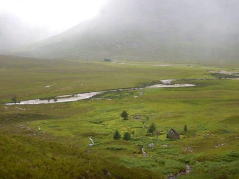
Two rivers and a huge expanse of bog must be crossed to reach the path at Larachantivore before the climb into the high mountains can even begin.
This through-route provides the basis for the Great Wilderness Challenge, which is coming up next month and which I will be taking on for the first time. It charts a course from Corrie Hallie at Dundonnell to Poolewe, 25 miles through this challenging country.
I am familiar with the western end of the route between Carnmore and Poolewe but wanted to see what the other end of the course was like, especially those rivers.
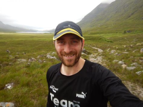
I set out to run this 12-mile circuit taking in the bothy and another abandoned house at Achneigie, though I had no intention of testing out the river crossings by myself today. These can prove dangerous and, when in spate, are impossible, so I wasn’t taking any risks.
Opposite the layby, a right of way sign points to Poolewe, Gruinard and Kinlochewe. The path looks gentle enough at first as it heads away from the road and bends sharply right to reach a gate but, after going through the gate and following the track left, things start to get a little tougher.
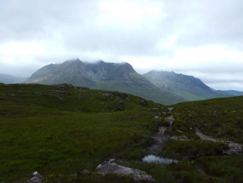
The route climbs above the burn which tumbles through a nice birch wood, seemingly getting steeper with every twist and turn. My heart rate was already at maximum as I got my first glimpse of the angular ridge line of An Teallach rising high to the right.
Eventually the rough track levelled out but only to reveal the next big rise. The track fords the burn but I ran round to cross at a small wooden bridge before concentrating on making it up the next kilometre or so to the high point of the route.
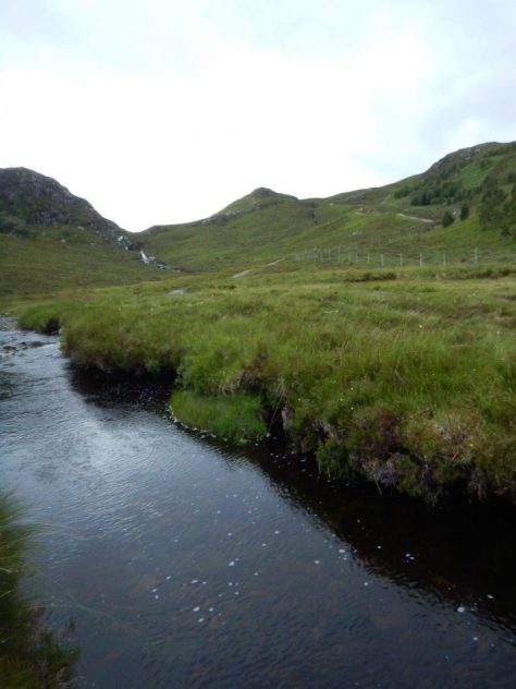
I was gasping when I reached the large cairn at the top but at last the next section looked runnable. The route to Shenavall forks right, away from the main track, at twin cairns, and I followed the initially clear path over rocks and through increasing amounts of bog.
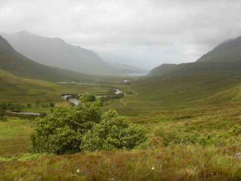
As I rounded the shoulder of Sail Liath, the sight of Beinn Dearg Mor ahead dominated the view, still impressive despite the cloud clinging onto the top of this mighty Corbett. My eyes were firmly on my feet, though; quick thinking being required to stay upright and not slip on the wet ground.
The eroded path leads you through a narrow little glen that drops steeply down to Shenavall. Now I could see the two rivers converging before entering Loch na Sealga, and the route ahead was laid out for me. It seemed less daunting now, faced with the reality, but I was still pleased I didn’t have to get my feet wet – or, at least, any wetter – on this circuit.
After exploring the bothy and chatting to a fellow visitor – a Belgian who was stone deaf, which made communication somewhat difficult – I found the path that runs south-east along the Abhainn Srath na Sealga and enjoyed the most actual running I’d done so far!
I was soon at Achneigie, the building falling into a state of disrepair despite the locks on one half of it, and continued on the vehicle track beyond. After just over another kilometre, the track turns away from the water and begins the steep climb back up the pass. The view down Strath na Sealga towards Shenavall and the loch was beautiful in the afternoon light which shone between the lingering clouds, and it made for a good excuse to rest a little on the climb.
Knowing there was downhill to finish made this heart-racing ascent not quite as intimidating as the start of the route, though I was pleased to finally reach the cairn so I could enjoy the speedy descent to Corrie Hallie.
Route details
Shenavall circuit
Distance 12 miles / 20km
Terrain Rough track and very boggy path with steep sections
Start/finish Corrie Hallie layby, Dundonnell, at grid reference NH115851
Map OS Explorer 435, An Teallach & Slioch
A trip to the edge of the wilderness makes for a challenging run or a long walk
The Great Wilderness Challenge
The challenge has taken place every year since 1986, raising £3.6 million for charity in the process. It is a family-friendly event for everybody from elite runners to strollers, with route options at seven, 13 or 25 miles, with limited mobility walks of 1.4 or 2.8 miles.
This year’s GWC takes place on Saturday, August 12, from its base at Poolewe. There is a prizegiving ceremony and event ceilidh/dance in the evening – for those who still have energy left in their legs!
I’m taking part in the 25-mile run, described by organisers as a “strenuous route in amazing surroundings, requiring serious fitness preparation”. Keep an eye on Active Outdoors to find out how I get on.
For more information about the challenge, see http://www.greatwildernesschallenge.info
* Article first published in Active Outdoors | July 28, 2017